

Komoot is an application designed for cyclists and walkers to discover and share new routes or create your own.
The app offers a variety of cycling routes around the world that are also easily available on your favourite cycling computer. These routes are created by a community of cyclists and adventurers who share their knowledge and experience to help others enjoy a great cycling trip.
READ MORE: Our ideas for walks in the mountains: "Le Bélier des Aravis" in La Clusaz
There's a route for everyone, and if not, you can easily create your own. Whether you have a gravel bike, a road bike, a mountain bike or an electric bike, Komoot offers routes suitable for all types of bikes.
Several subscription options
But you're going to tell us why using Komoot ? For several obvious reasons. Because you can't go rummaging around in your pockets looking for your phone when you're in the middle of a descent, because checking your screen regularly uses up battery power, and because nature deserves your undivided attention, Komoot is there to support you.
And using the route planner from Komoot is free and once you've planned your route. You can then start navigating directly from the application.
However, if you want to navigate offline or synchronise your route with your navigation device, you will need a map showing the starting point of the route.
When you create an account KomootYou get your first zone for free. Additional individual regions are available for €3.99, regional packages are available for €8.99 and the full package Komoot World can be purchased for €29.99. These are all one-off payments!
Valuable information available
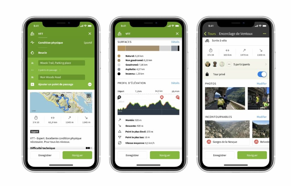
In the left-hand menu bar of the IT route planner (in the application, scroll down in the planner), you'll see an overview of the types of roads and pavements for your journey. For example, you can search for provincial road segments and delete them if necessary by moving the blue line to another road.
You can also view the exact kilometres of cycle paths, gravel roads or technical trails on the route in the menu. This allows you to adjust your route accordingly and avoid unpleasant surprises along the way.
READ MORE: Mountain biking: Bikes parks, trails... What's new this summer in our resorts?
If you're heading for the mountains, the route planner's altitude profile is useful. It shows you where the steep climbs are on your route, their exact length and at what point in the route you started climbing.
When planning, you can use different maps. The satellite map clearly shows nature reserves, sandy plains, residential areas and mountainous landscapes, and in the Open Cycling MapYou'll find all the nodes where France's official cycle routes are distributed. You can also activate the display of tracks on the map.