

The winter mountains are an exceptional playground, but they don't forgive improvisation. If you're a ski tourer, you know that the success of an outing depends not only on the moment you put on your skis, but also on the day before, comfortably seated on your sofa. This is the famous preparation phase.
For decades, this preparation was done exclusively on paper topographic maps (the famous IGN 1:25,000 map). Although indispensable and always necessary for the back of the pack, the 2D map shows its limitations when it comes to interpreting the complex terrain of a snow-covered massif. This is where modern technology, and more specifically 3D mapping, changes the game in terms of safety.
The crucial issue of slope reading
When it comes to ski touring, avalanches are enemy number one. As well as snow conditions (which we consult via BERA), it's the topography that dictates the risk. We learn at a very early age to be wary of slopes in excess of 30 degrees.
On a paper map, assessing these slopes requires expert reading of the contour lines: the closer together they are, the steeper it is. But our brains sometimes have trouble converting these abstract lines into a reality on the ground. Is this corridor really passable? Does this crossing expose the group to an overhanging slope?
This is where a miscalculation can occur. A rough reading at home can lead you, once in the field, into a «trap» zone where turning back becomes complicated.
3D visualisation: Rehearse your race before you run it
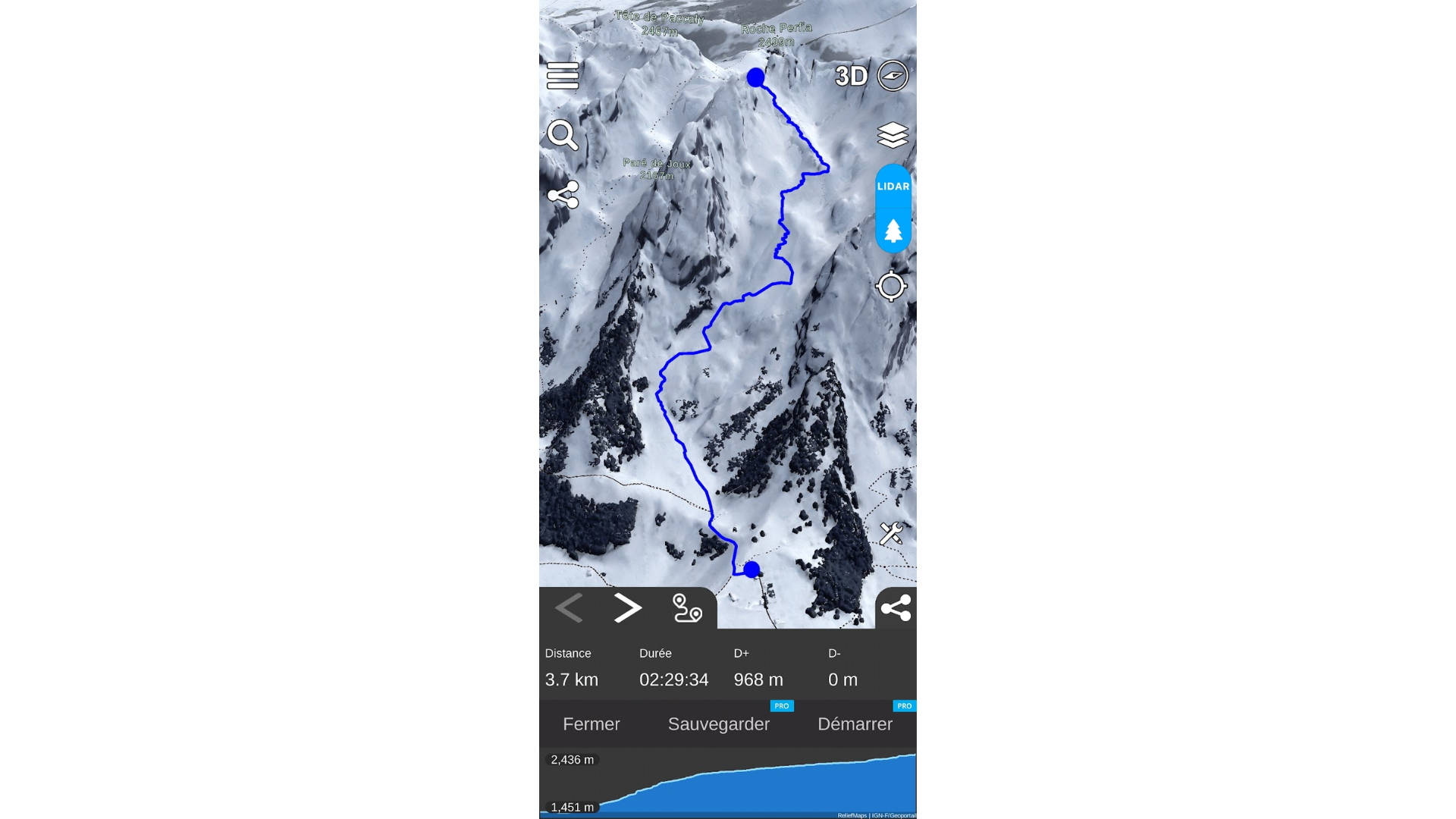
The major contribution of the new digital tools is the ability to view the terrain in three dimensions. Imagine being able to fly over your route, observe the terrain from every angle, and spot flat areas or rocky bars as if you were there.
This immersion allows you to create a precise «mental image» of your outing. By visualising the route in 3D, you memorise the key points: «after this knoll, I have to pull left to avoid the steep slope». This preview reduces the mental load once you're on your skis, allowing you to concentrate on technique and observing the snow.
Choosing the right tool for orientation
To move from theory to practice, it's essential to have a reliable tool. Today, the smartphone has become a genuine safety co-pilot (provided you manage your battery!).
However, not all GPS applications are equal when it comes to mountaineering. For optimum preparation, you should choose a ski touring application specially designed for winter needs. Unlike traditional summer hiking apps, a specialised tool will give you precise slope layers and realistic terrain rendering.
This is exactly why tools such as Relief Maps have been developed. The aim is not to replace your marine sense of the mountains, but to enhance it. Using a dedicated application, you can plot your route directly on the 3D map, which gives you an immediate idea of the physical difficulty (difference in altitude/distance) and technical difficulty (gradient) of the planned outing.
In the field: The importance of offline mode
Once you've finished getting ready and you've got your skis on, the technology has to disappear into the background while remaining available. The mountains remain a white zone for mobile networks. So it's vital that your mapping tool allows you to download offline areas easily.
One of the most stressful situations for a skier is to find yourself in the fog (the «white day») without any visual reference points. In this case, being able to take out your phone and see your exact GPS position on a relief map, even without a network, is a huge safety factor. It confirms that you are not drifting into a dangerous area.
In addition, applications such as Relief Maps often include community or tracking functions that allow you to analyse your performance on your return (gradient, speed, actual route vs. planned route).
Conclusion: Using technology to exercise caution
We must never forget that there is no such thing as zero risk in the mountains. No application, no matter how sophisticated, can ever replace training, experience and giving up in bad conditions.
However, it would be a mistake to do without modern 3D visualisation tools. They are an additional safety filter. By meticulously preparing your route with a realistic view of the terrain, you set off with a head start. You don't discover the mountain, you recognise it. And when it comes to safety, that difference changes everything.